
Why Infrastructure Projects Start With Accurate Survey Data
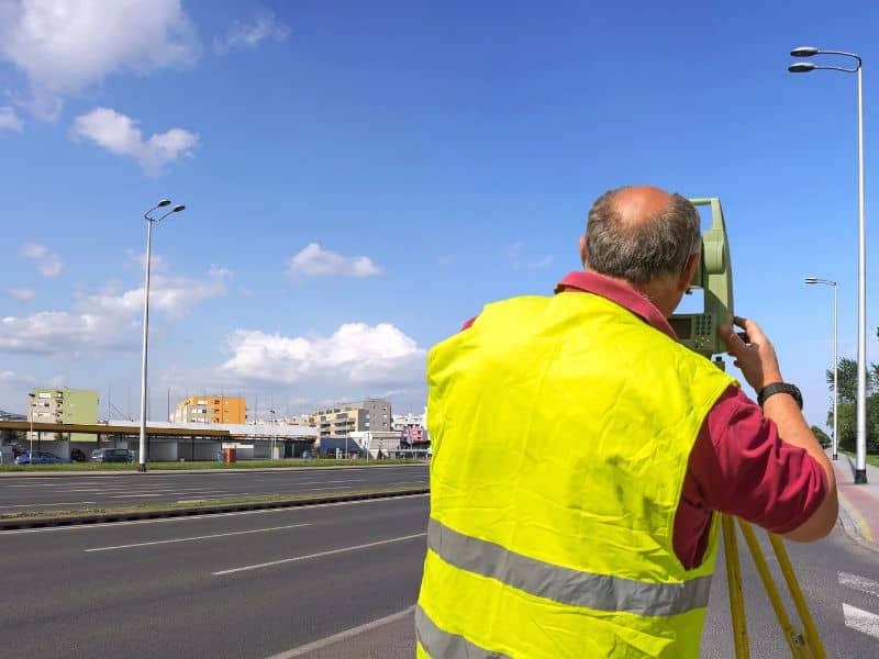
A storm sewer that’s off by a few tenths of a foot can back up instead of drain. A road widening drawn on the wrong right-of-way line can stall for months while land rights get sorted out. These problems rarely start in the field. They usually start with weak survey data that nobody questioned during design.
Land surveying gives engineers, public agencies, and developers a measured picture of the site before anyone draws a final plan. It shows what’s there, where property lines fall, how the ground slopes, and where utilities run. If you’re funding, designing, or approving a road, pipe, or site project, good survey data is one of the cheapest ways to control risk.
Building an Accurate Existing Conditions Base Map
An existing conditions base map is a scaled drawing of everything on and around the site as it stands today. Surveyors locate pavement edges, curbs, buildings, trees, manholes, inlets, signs, and other visible features. Engineers then design new work right on top of that map. If the map misses a retaining wall or a fire hydrant, the design will miss it too.
The map should fit the project. A sidewalk repair may only need a narrow strip of data, while a new road or utility corridor needs detail past the work limits so designers can tie into what’s next door. Before field work starts, have your engineer and surveyor agree on these items:
- survey limits and how far past the work area they extend
- features and level of detail the design team needs
- coordinate system and vertical datum for the drawings
- file format and drafting standards for delivery
Datum questions sound minor, but they cause real trouble. If the new survey uses one elevation reference and older plans use another, the numbers won’t match. Settling this early saves a lot of rework.
Mapping Boundaries and Right-of-Way for Infrastructure Design
Right-of-way is land a public agency or utility owns or controls for a road, pipe, or other public use. Infrastructure work has to fit inside it, or the owner needs new land rights before building. A surveyor finds those limits by researching deeds, plats, and road records, then tying them to monuments found in the field.
This matters most on widenings, new intersections, and utility extensions. Designers need to know if a turn lane crowds a front yard or if a pipe route crosses private land. Where it does, the owner may need a permanent easement, a temporary construction easement, or a purchase, and each one takes time.
Records don’t always agree. Old road plats can conflict with newer deeds, and monuments disappear over years of paving and repairs. Ask your surveyor to flag any gaps, overlaps, or unclear lines so your team can plan around them. Right-of-way plan standards can vary by agency, county, and funding source, so confirm them up front.
Capturing Elevations for Grading and Drainage Planning
Elevation data shows how high or low each point on the site sits. Surveyors collect spot elevations, break lines along curbs and ditches, and invert elevations, which are the bottom inside heights of pipes and culverts. Engineers use that data to build a surface model and design slopes that move water where it should go.
Infrastructure leaves little room for error here. Gravity sewers and storm drains often run on slopes under one percent, and a new pipe has to meet existing pipes at the right depth. Roads also need cross slopes that shed rain without ponding at the curb.
Pay close attention to tie-in points. When it’s safe and allowed, surveyors should open structures and measure inverts directly, since record drawings are often wrong. If the site sits near a creek or floodplain, ask whether extra cross sections or flood data are needed for review.
Coordinating Utilities With Reliable Survey Data
Buried utilities cause many of the cost overruns on infrastructure jobs. Gas, water, fiber, power, and sewer lines often share one narrow corridor. When a design runs a new pipe through a spot an old one already fills, the conflict usually shows up during digging.
Survey data helps cut that risk. Surveyors locate valves, poles, vaults, and manholes, and they map the paint and flags placed by locating services. On tighter projects, owners often add subsurface utility engineering, which can include test holes that expose a line so its exact depth can be measured.
Know the limits of each source. One-call marks are approximate and meant to keep digging safe, so they aren’t precise enough for design work. Record maps can also be decades old. Decide early how much utility detail your project needs and budget for it.
Carrying Survey Control From Design Into Construction
Survey control is a network of fixed points with known coordinates and elevations. Surveyors set these points as iron rods, nails, or benchmarks, and every measurement on the project ties back to them. Good land surveying keeps that same control in place from the first design survey through the last construction stake.
When control stays consistent, stakes in the ground match the plans. Curbs line up, pipes hit their inverts, and new work meets old work as drawn. When a contractor’s crew uses different control, small shifts add up to costly field fixes.
Protect control points during the job, since equipment and trenching can wipe them out fast. Ask for a control sheet in the plan set listing each point, its coordinates, and its description. Make sure the construction surveyor checks into that control before setting any stakes.
Frequently Asked Questions
What type of survey does an infrastructure project need?
Most projects start with a topographic and existing conditions survey. Many also need right-of-way research, utility mapping, and survey control. The right mix depends on the project type, funding source, and reviewing agency. Your engineer and surveyor should define the scope together before field work begins.
How long does land surveying take for an infrastructure project?
Timing depends on site size, records research, and field conditions. A small site may take a couple of weeks, while a long corridor can take much longer. Traffic control, weather, and access to private land can add time. Bring the surveyor in early so survey work doesn’t hold up design.
Can old survey data be reused for a new project?
Sometimes, but it should be checked first. Sites change through new paving, additions, and utility work. Older data may also use a different datum than current plans. A surveyor can review it, field check key points, and update what has changed.
Who is responsible for locating underground utilities?
The work is usually shared. Utility owners and one-call services mark lines for excavation, and surveyors map visible features and those marks. Design-level detail may require subsurface utility engineering, which the owner often pays for. Contract terms and local rules decide who handles what.
Why does survey control matter after design is done?
Construction stakes are only as good as the control behind them. If the contractor works from the same points used in design, the built work should match the plans. Different control can throw off pipe grades, curb lines, and tie-ins. One control network from start to finish protects both quality and budget.
